Manombo
- Accueil
- Special Reserve
- Manombo
In terms of plant cover, Madagascar is divided into five natural regions (CNRE/JERNT 1991). Each region is in turn subdivided into sub-regions. Réserve Spéciale de Manombo belongs to region II, sub-region II6 (11,954 km2 in surface area), formed by the south-east coastline along the south-east coast from Vohipeno to Manambondro. The topography of Manombo Special Reserve comprises coastal plains, rolling hills and alluvial valleys.
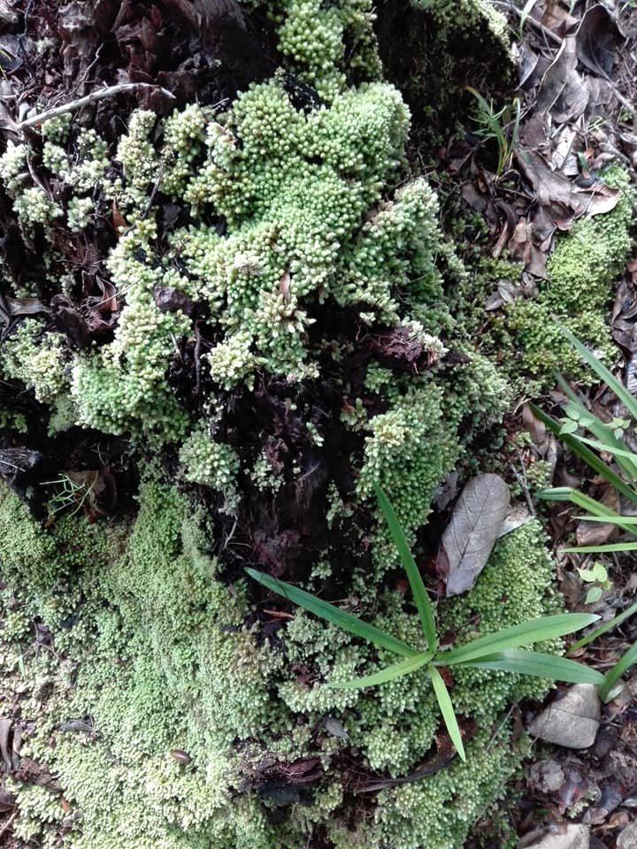
Soils in the Manombo region are basaltic, red ferralitic concretions or more or less indurated in plot 1, but sandy on the beaches and coastal dunes and peaty (rich in sulfur) in the swamps of plot 2.
Concretions or karaoka are very abundant on the surface and are characterized by low silica content and high iron oxide content.
The region’s climate is hot and humid. The average annual temperature is 23°C, with a maximum of 31°C and a minimum of 13°C. January and February are the hottest and wettest months, while June and July are the coldest. The dry season runs from August to November, but is most marked in October.
Average annual rainfall is 2,706 mm over 219 days. The highest rainfall occurs from December to April, and March is the wettest month with 338 mm. The lowest rainfall value is 108 mm in September. There is no real dry season, as the coast benefits from the trade winds. The Reserve’s position exposes it seasonally to tropical cyclones. Historically, however, two cyclones have caused massive habitat degradation and loss of biodiversity. These were the cyclone of March 22 1956 and cyclone Gretelle on January 24 1997. These cyclones brought very violent winds reaching 150 km/h and 450 km/h respectively, and defoliated and felled trees. The after-effects of Cyclone Grettelle can still be seen in the interior of the forest, but the forest is now almost fully recovered.
1.5. The Reserve’s natural resources
The RS de Manombo plays a number of strategic roles. It ensures the conservation and representation of typical and unique habitats of the South-East region of Madagascar in the national network of protected areas, through the eastern littoral forest (FLO) characterized by a typical plant formation of hintsy (Hintsia bijuga) which is an endemic species of Manombo developing on the sand and littoral dunes of plot 2 (cf plangrap). This eastern littoral forest of Hintsia bijuga is the only one represented in the network, covering an area of 1,055 ha with a maximum altitude of 30 m.
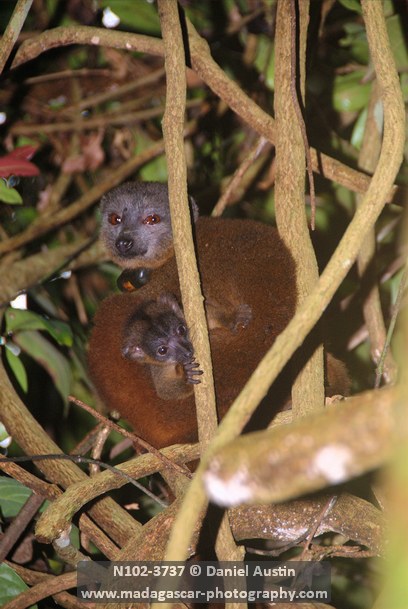
The Reserve is also home to a low-lying humid forest (0-400 m) or FHBA, which develops on the plain and ferralitic soil. This vegetation formation is located to the west in parcel 1 of the Reserve. It covers an area of 2,410 Ha and is characterized by the presence of Humbertia madagascariens (fatsinakoho), a species endemic to Manombo, and to the region 200 km to the south, near Fort-Dauphin. Seven species of diurnal and nocturnal lemurs can be found here, one of which is endemic to Manombo. Indeed, RS Manombo contributes to the conservation of the largest proportion of the critically endangered and rare Eulemur cinereiceps lemur species. Manombo is the southernmost part of the region where the endangered Varecia variegata variegata lives.
New species of freshwater fish were discovered in the reserve in 1994. These species exist nowhere else, and belong to the rare endemic genus Pantanodon (family Poecillidae), Betodia sp and Paratilapia sp. However, the current existence of the Pantanodon species has not been confirmed by a specialist researcher in the field, who is carrying out his research in the Reserve in September this year.
In addition, the Manombo Special Reserve is the only PA where the critically endangered reptile species Mantella bernhardi is found, and is home to the greatest diversity of land snails (52 species have been found)on all lowland forests.
As far as ecological functions are concerned, the reserve plays an important role as a source of irrigation water through the hydrographic network it contains. These include the Takoandra and Menatsimba rivers with their streams, and the Sanalaotra river, a tributary of the Takoandra, which rises in the wooded hills of plot 1 and the classified forest, crossing the communes of Ivandrika and Vohitromby 15 km north of the reserve, and which can irrigate up to 300 ha of rice fields within these two communes. In addition, Sanalaotra contributes to the water supply of the town of Farafangana.
Main ecological features :
Ankarafantsika National Park belongs to the aquatic ecoregions of Madagascar’s western and north-western basins, and to the western terrestrial ecoregion. This National Park is one of the largest blocks of semi-deciduous dense dry forest in western Madagascar. It includes the following natural environments: dense dry forest on sand, riparian forest, raffia forest, xerophytic thickets, grassy and shrubby savannahs, swamps, permanent lakes and rivers.
History
Decreed in 1962 as Manombo Special Reserve N°8, under creation decree n°62-637 of December 05, 1962, the Reserve covers an area of 5,320 Ha. Following declassification by decree n°67-051 of January 31, 1967, it now covers 5,080 Ha. This downgrading includes 240 Ha in the Manombo village cultivation perimeter.
Endemic species
Humbertia madagascariensis,
Erythroxylon ampullaceum, Cleistanthus, Dalbergia baroni, Dalbergia louveli, Uapacca spp, Canarrium, madagascariensis
Fauna
Eulemur Cinereiceps, Varecia variegata variegata, Hapalemur griseus, Lepilemur sp, Avahi laniger, Microcebus rufus, Chéirogaleus spp
Flora
Humbertia madagascariensis,
Erythroxylon ampullaceum, Cleistanthus, Dalbergia baroni, Dalbergia louveli, Uapacca spp, Canarrium, madagascariensis, Faucheria sp, Manilkara spp, Sideroxylon spp, Pouteria, Gambeya, Stephanostegia spp, Diospyros
parsieri, Filicium spp, Allophyllus spp, Tina spp,
Macphersonia spp, Craysophyllam, Ompalea sp, Weinmannia minutiflora, Wormia spp, Ocotea, Simphonia spp, Guttifrae, Wormia spp, Elaedendron, Anthostemma madagascariensis, Engenia spp
Fire, Cutting
Poaching, Honey collection
Biodiversity conservation
A number of initiatives have been planned to address the environmental challenges and human pressures on the park.
Conservation, Support and Development
Restoration project 20 with GERP
Restoration project with HiH
- Promotion des AGR et des reboisements (arbres fruitiers, bois d’*énergie, …)
- Implication des communautés dans les activités de conservation (patrouilles, suivis écologiques, lutte active contre les feux)
- Redynamisation de structure locale COSAP et CLP
Plain development with partner NGO
Development of Mahampy or penjy cultivation, mat making, etc.
Beekeeping and fish farming by partner NGOs
GERP
- HiH
MBG
On the plan
VISIT US
Depending on your means of transport :
- Ground Transportation
None
- Maritime transport
None
- Air transport
None
Fees and charges
Download the reference document to find out more about park fees and charges.
The circuits
| Tours | Summary | Difficulty | Duration | Tour plans |
|---|---|---|---|---|
| Reharatry | Piste de 3 km Reharatry on trouve une piscine naturelle et les lémuriens diurne |
Madagascar National Parks
Immerse yourself in the unique biodiversity of our national parks and discover our commitment to conservation and ecosystem protection. Marvel at unspoilt landscapes and exceptional wildlife. Together, we create a model of responsible and beneficial coexistence
