Anjanaharibe Sud
On the plan
Reservations are recommended but not essential. Information
VISIT US
Depending on your means of transport :
- Ground Transportation
🚗 Step 1: Travel to Sambava
🛶 Step 2: From Sambava, take the RN3b to reach Andapa (105 km)
🥾 Step 3: From Andapa, travel to Andasibe Mahaverika via a secondary road (17 km)
- Maritime transport
🛳️ There is no direct sea connection to the Reserve, but you can reach Antalaha by boat and then take the RN5a from Antalaha to Sambava, or reach Vohemar by boat and then take the RN5a from Vohemar to Sambava.
- Air transport
✈️ There are no direct flights to the Reserve, but you can reach Sambava by plane.
🗓️ When to visit Anjanaharibe-Sud ?
🌦️ All year round
The Reserve remains accessible in all seasons.🌸 Best time to visit:
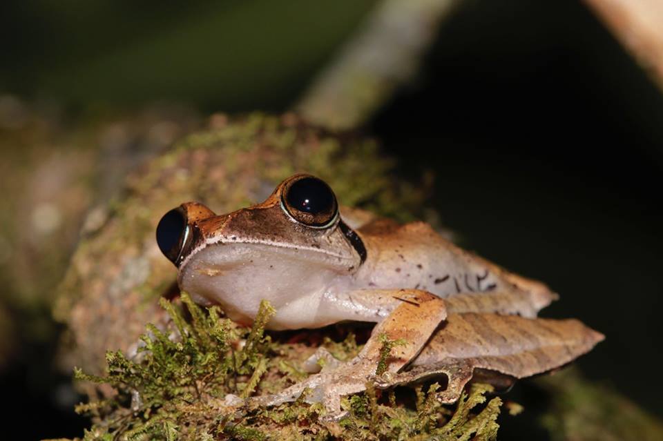
Dry season, which runs from August to mid-November🌧️Access is difficult from January to September due to rain, but ideal for observing amphibians
🌿 Activities available in Anjanaharibe-Sud
🥾 Hiking
⛺ Camping
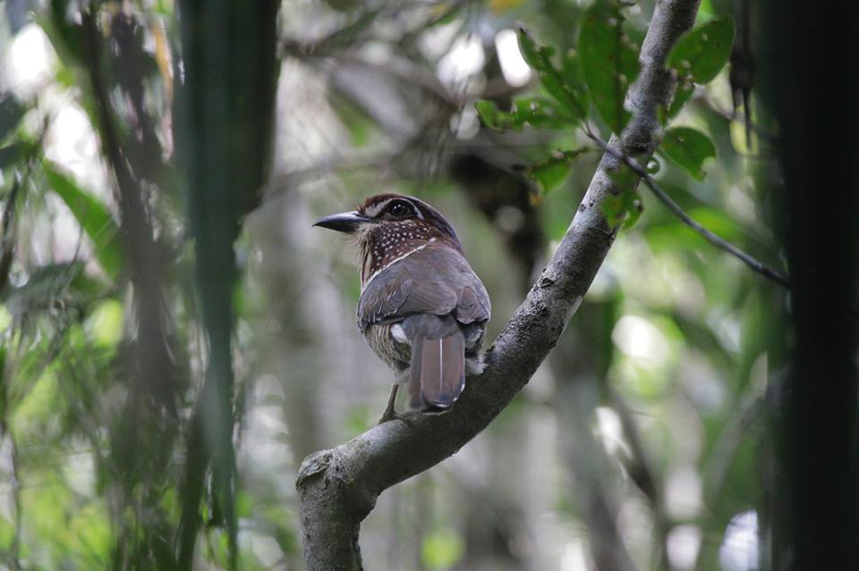
🦜 Bird watching
👣 Guided tours
📚 School trips
🚶♂️ Nature excursions🏕️ Reception facilities
🏠 Reception office and interpretation center: Located on the side of the RN3b road in the village of Manantenina, it provides visitors with information on prices, tours, and schedules, and organizes visits with local guides.
⛺ Rest shelters at the park entrance are located 5.6 km from the visitor center.
⛺ “Babakoto” campsite: 4 tent shelters, 1 shower and toilet, 1 dining shelter with table and bench, 1 store selling camping equipment and kitchen utensils.ℹ️ Essential information
To make the most of your visit, bring:
🥾 Appropriate clothing: hiking boots, light but covering clothing, waterproof jacket (a few showers are possible even in the dry season)
🦟 Mosquito protection: repellent, cream, or mosquito spray
🔭 Binoculars: ideal for observing animals from a distance
💧 Useful accessories: water bottle, hat, sunglasses💰 Fees and rates
📄 Consult all rights and rates applicable to the reserve in the reference document below.
📜 Rules of conduct
🚫 No touching animals or buying forest products
🎫 Always have a ticket with you on each visit
👨🏫 Guided tours with a certified guide are mandatory
The circuits
| Tours | Summary | Difficulty | Duration | Tour plans |
|---|---|---|---|---|
| Access track | Beginning the hike before arriving at the entrance, visitors have the chance to discover the daily life of the local population: agriculture, their customs, species of chameleon, snake, ... | 4h walk | ||
| Taktha circuit | Discovered by researchers in 1909, takthajania was considered extinct until 1994, when its existence was rediscovered in the RS Anjanaharibe Sud. It was one of the dinosaur plants. Forests of this small tree can be found at altitudes of 1000m and above. The takhajania circuit is 4km from the main trail, and takes between 2h30 and 3h to complete, with an altitude difference of between 800 and 1200m. | 2h30 to 3h walking time | ||
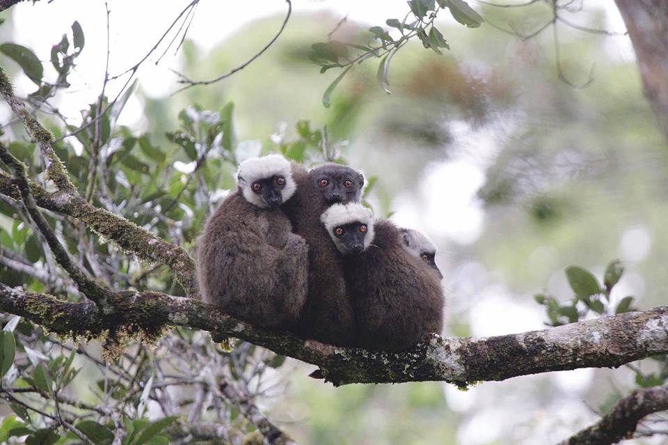
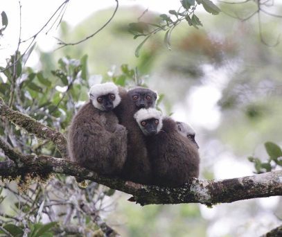
| Babakoto circuit | Locally known as Babakoto, a species that is endemic to the SAVA region, indri all in black, is to be discovered in the Reserve. During the warm season, from September to April, this species is easy to see. Alternatively, during the southern winter, the calls of the indri can be heard up to 3km away. | 1 to 2 hours | ||
| Ranomafana Circuit | Visitors to the Reserve can discover a number of thermal springs. The springs in the basins are used by villagers for traditional purposes and to cure illnesses. Tourists can enjoy taking a dip in one of the pools. These springs converge on the Marolakana River. The circuit takes in low-altitude forests. It is about 5 km from the main trail. Visiting these springs will depend on the weather, especially when crossing the Marolakana River, which remains difficult due to rising water levels during the rainy season. | 2 to 3-hour walk from Indri camp | ||
| Takthajania tour | Following the national road linking Andapa and Bealanana through the Reserve, about 3km from the Indri camp, you'll come to an extraordinary place. Passing this river, people take advantage of the beauty of the place to rest and have lunch after walking for around 3 hours. Motorcycles are also transported by 4 to 6 people to cross this river. It's a place where visitors can discover the daily life of people in the region. Tourists enjoy picnicking here, given its beauty. | 2 h walk |
Discover our National Parks and Reserves.
Madagascar National Parks
Useful links
